Waukeag Neck, Maine
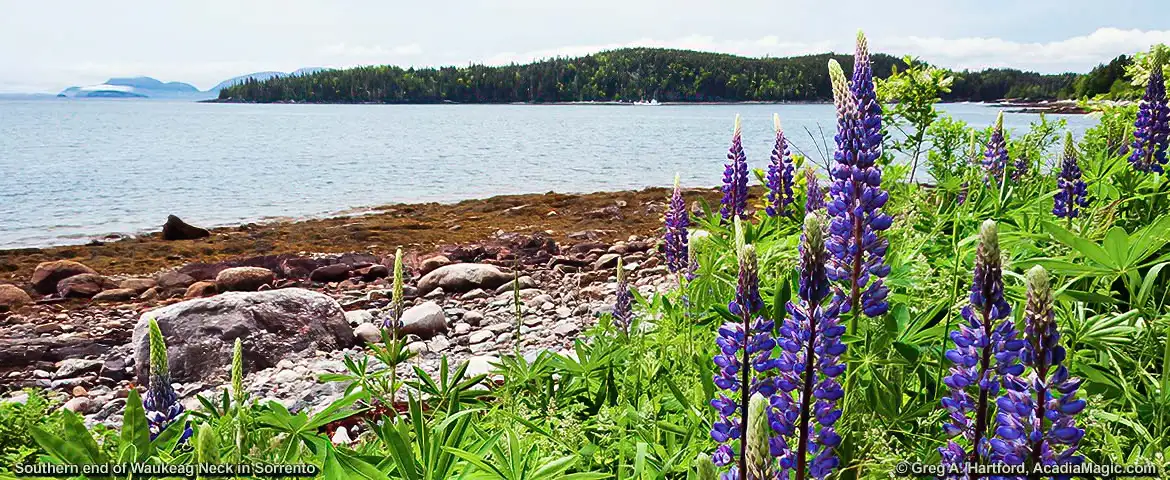
Waukeag Neck is located on the coast of Maine just south of Sullivan and Downeast of Ellsworth in Hancock County. Sorrento, a summer resort and coastal fishing community is the primary town occupying the land mass. The picture above shows wild lupines on the southern shore of Waukeag Neck in Sorrento looking southwest toward Preble Island (in the center) and Mount Desert Island (in the far distant left). You can faintly see a fishing boat that just left a Sorrento fishing company through Mt. Desert Narrows on its way back out to sea.
Waukeag Neck is on the south side of Coastal US One. The exit point to begin heading south is at the intersection with Route 185 (East Side Road). The following are the GPS coordinates.
Entry to Waukeag Neck GPS: 44.512247, -68.180682
Historical Background:
Waukeag was a word used by the Penobscot and Maliseet tribes to describe a natural glacial formation called a “kame” that resembled a horse's back. A kame is a hill or mound of gravel and sand formed by streams on the bottom of slow moving glaciers. When the glaciers melted, they left these deposits throughout Maine. Waukeag meant “a horseback in a place where the tide runs out strong” and referred to the kame in the great tidal stream that fills Sullivan Harbor, Sullivan Falls north through Taunton Bay and Hog Bay in Franklin.
Other than having family roots in an area that one visits, I know of nothing that enriches the experience more than having some sense of history. Learning about the early Native American culture and the early European settlers creates a time-line and point of perspective. We, the people of the 20th and 21st centuries, have little appreciation for how difficult those times were. We are used to the numerous conveniences that our times provides. Just think about how time has been compressed and shortened driving in automobiles across paved roads. Then look at the distances traveled then by foot through the forests.
Additional Information
- Sorrento Town Government: (207) 422-6889
79 Pomala Ave., Sorrento, ME 04677 - The Sullivan-Sorrento Historical Society: Website
P.O. Box 44, Sullivan, ME 04664
(207) 422-0995
- Golf Courses
- Chamber:
P.O. Box 381, Winter Harbor, ME 04693
(207) 963-7658
More Travel Details
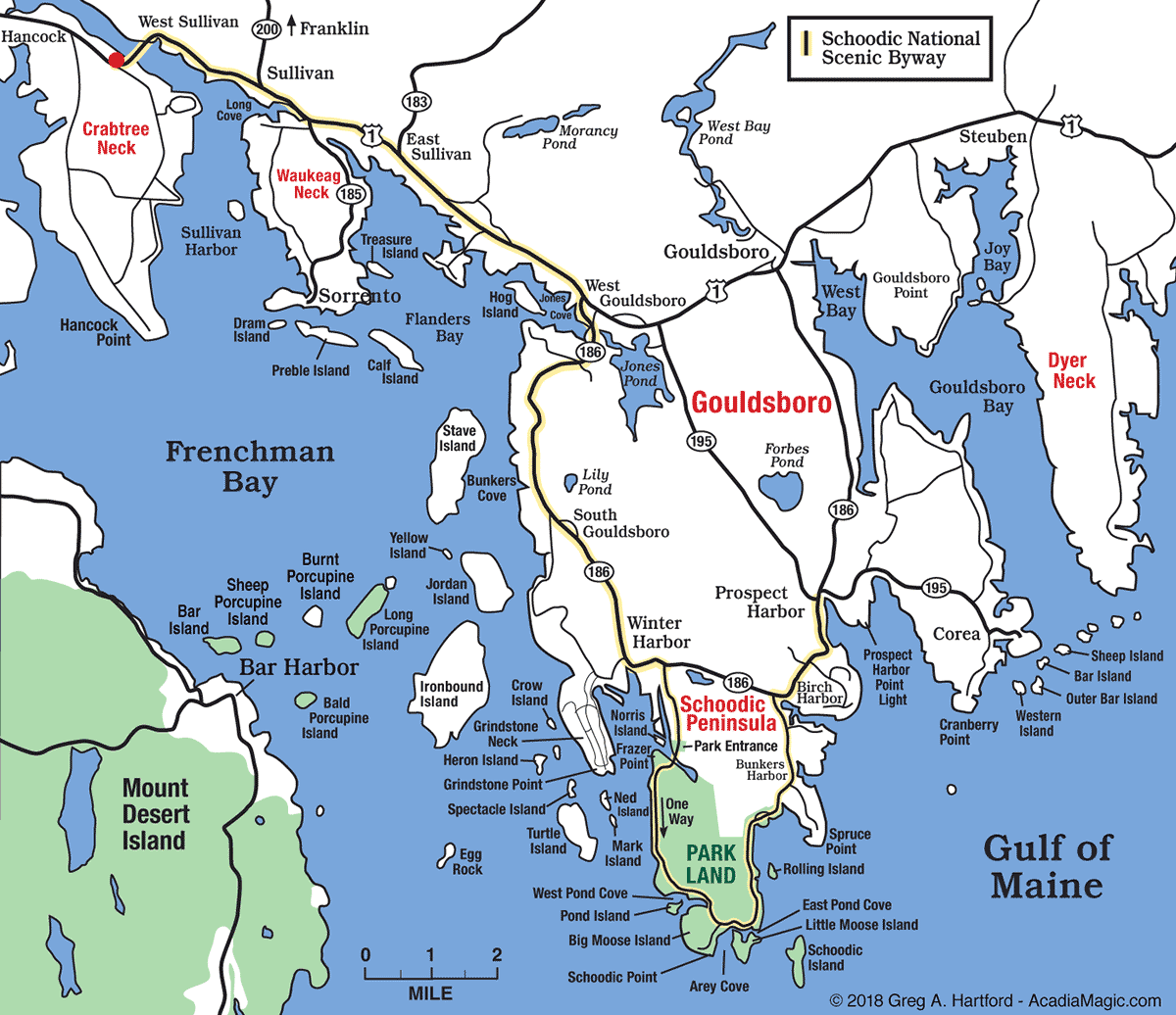
 Sorrento, at Waukeag Neck's tip, is about 14 miles (23 km) from Ellsworth and 14 miles (23 km) from the entrance to the Schoodic Peninsula section of Acadia National Park. View the Schoodic Map to see how to get there.
Route 185 (East Side Road) goes along the eastern side of Waukeag Neck. Shortly after Blink Bonnie Golf Course, the road takes a sharp western turn to the right. About 1/2 mile after, the road takes another sharp turn but to the left this time towards the South. Route 185 ends less than 1/2 mile in Sorrento. To enter Sorrento or reach the town dock, take a right. From the town dock area, you can go East along Ocean Avenue which hugs the shoreline, then loops back around as Doanes Point Road. From the same town dock, Ocean Avenue can also be taken West to loop around Sorrento. The road loops back around as Bay View Avenue.
![]()